|
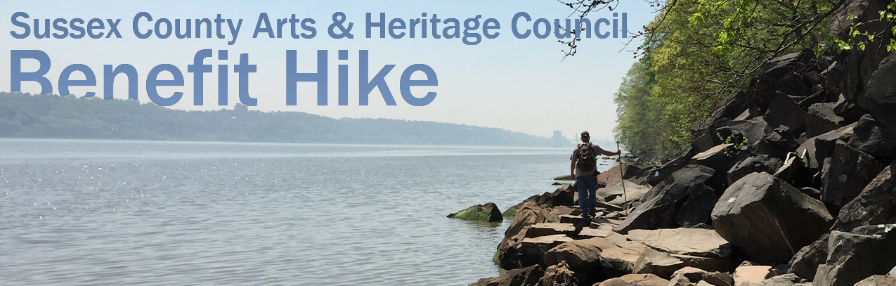
This hike took place on March 22 and we had a great turnout! We hope to do anther Benefit Hike soon! |
This benefit hike, guided by Jeff Stoveken, took hikers from the Palisade Cliffs to the water’s edge to view the Cornerstone of New Jersey. Jeff Stoveken created Sussex County Excursions to provide a visual tour of Sussex county and the surrounding area from a historical point of view. He also served on the SCAHC Council in 2014.
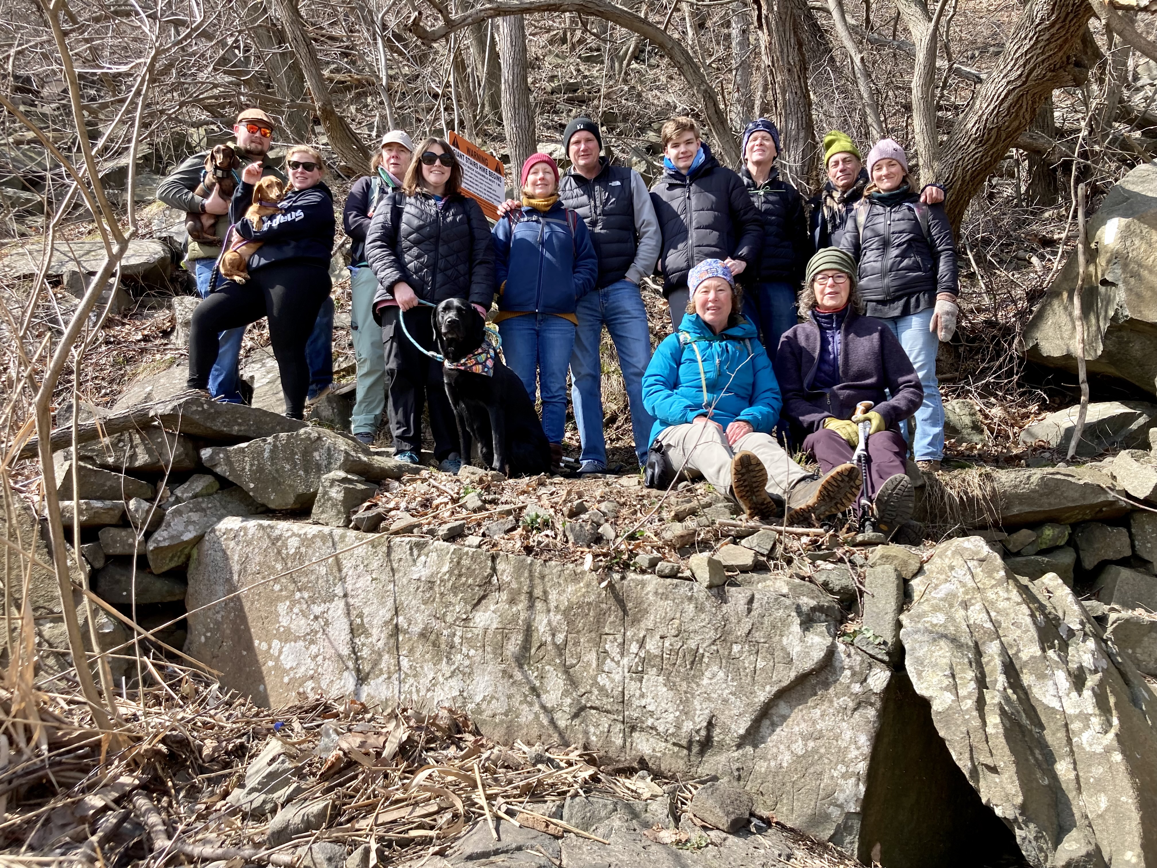
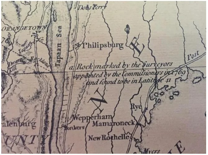
Finding the “corner stone” to the state of New Jersey created in 1664.
From 1664 until 1769 the border of New York and New Jersey had been fought over. Battles over land ownership along the state line could even turn bloody. We had learned that the anchor point on the edge of the Hudson River had basically remained the same from the beginning, but the line heading to the Delaware River had fluctuated a great distance north and south over the years. In a local history book I had read that there was a “Station rock” that sat at the waters edge of the Hudson River below the Palisade cliffs. Its inscription was Latitude 41 North with the words New York New Jersey on either side of a chiseled dividing line. How cool would it be to see this rock? Wondering if there’s still any evidence of that chiseled inscription all these years later. Imagine withered away headstones in a graveyard, some worn off completely and others barely readable.
 I needed to do a lot of research before we set out to find this rock. I knew of the area since I had worked over there for a few years. I had been up and down the length of that river in that immediate area, and was familiar with how varied and wild it is. Dan pitched in and between the both of us we decided we were ready a little over a year later! Scouring old books and documents, many many maps, the older, the better, and putting everything together to create a plan to locate our target. One thing we could not locate was an actual photograph of this particular marker. We kept coming up with a photograph of a witness monument dated 1881 which was located at the very top edge of the cliff and part of its inscription said located 488 feet west of this marker is where the line begins. Why was there not a picture of this very important rock?
In the interim of our research, I had contacted the head of the New Jersey DEP. His response was that they check on our border every so many years, clear and document the monuments, including photographs. For some reason, there is no documented photograph of this boulder. I asked him how to get there and he said the last team that he sent to locate it labeled it as “unreachable and never again”. I began to doubt our chances of ever seeing this rock. This was also compounded by my findings of a newspaper article that stated there was a recent Rockslide at the cliffs near the New York New Jersey border.
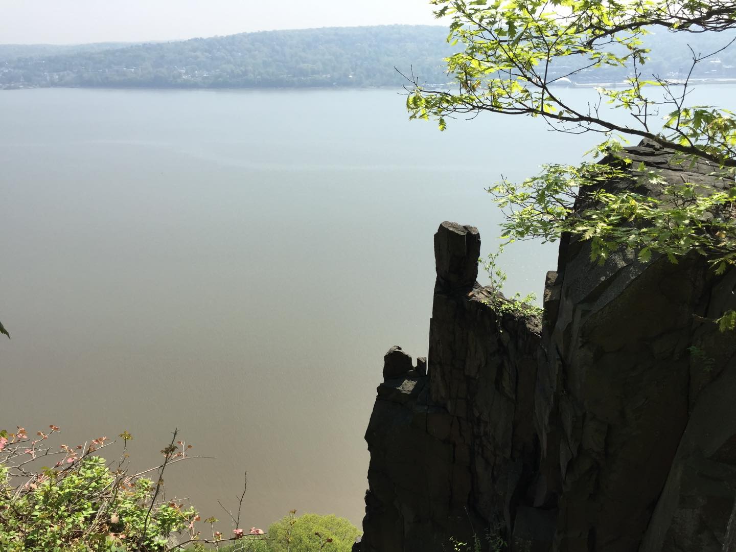 Well, we just needed to use all our information and go see for ourselves. We chose a beautiful sunny day to take a ride towards the city. Stopping short of the George Washington Bridge we headed north along the river and parked at the state line lookout parking area. After exiting the car, we walked over to the Stonewall that protects you from falling over the cliff and looked down in the direction of where we would be searching. At that moment, I honestly wondered what the heck were we thinking?! Staring down hundreds of feet below us where the waters edge was bordered by nothing more than boulders and sheer cliffs, I said, maybe our idea of accessing this spot floating down river in our kayaks was the better idea.
Well, we were here! Time to go and take a look for ourselves.
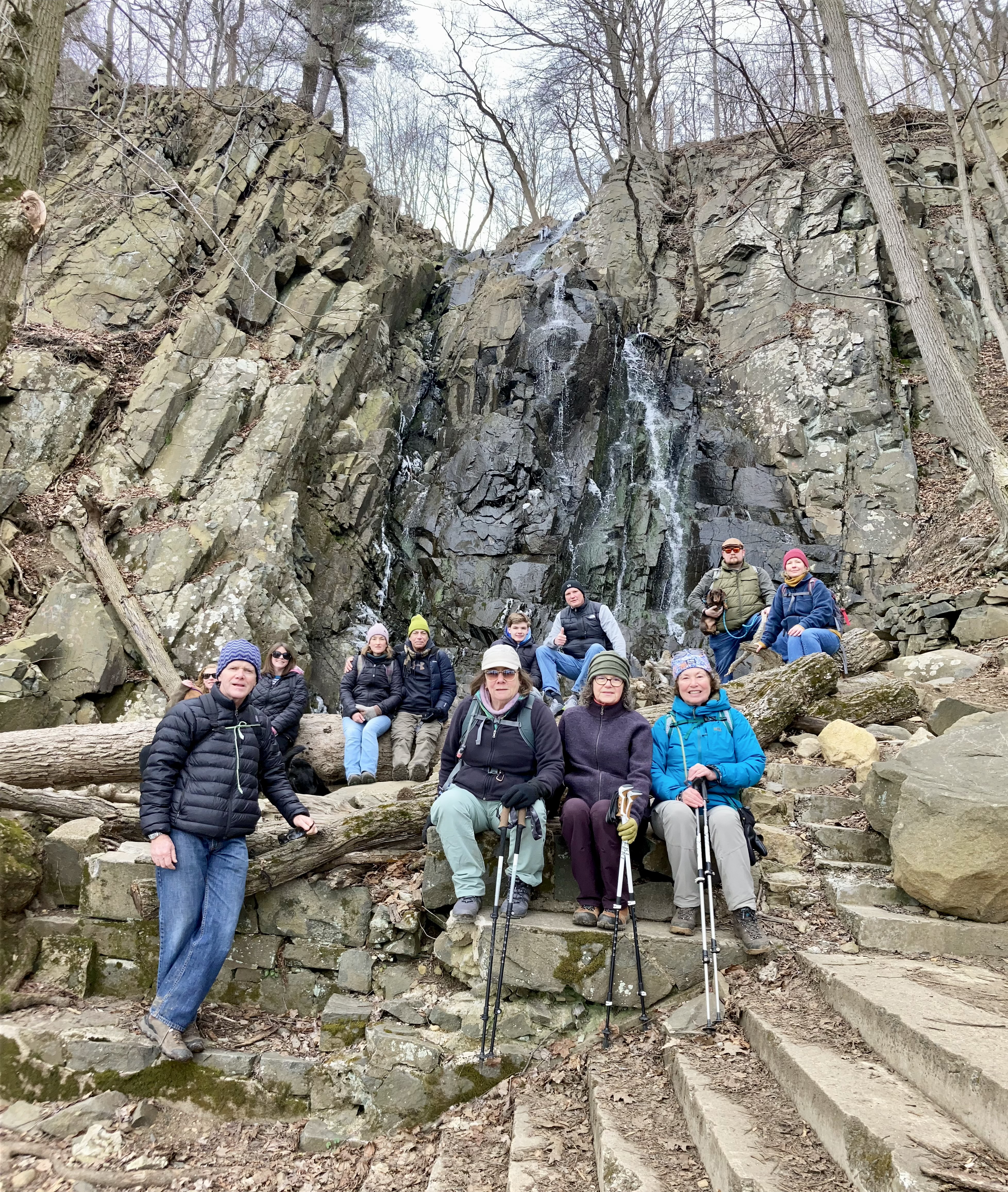
We found a trail which would allow us to descend to the bottom of the cliffs, it used the route of a waterfall called Peanut Leap Cascade. This trail would take us into New York and we would have to backtrack along the waters edge to get to the actual state border.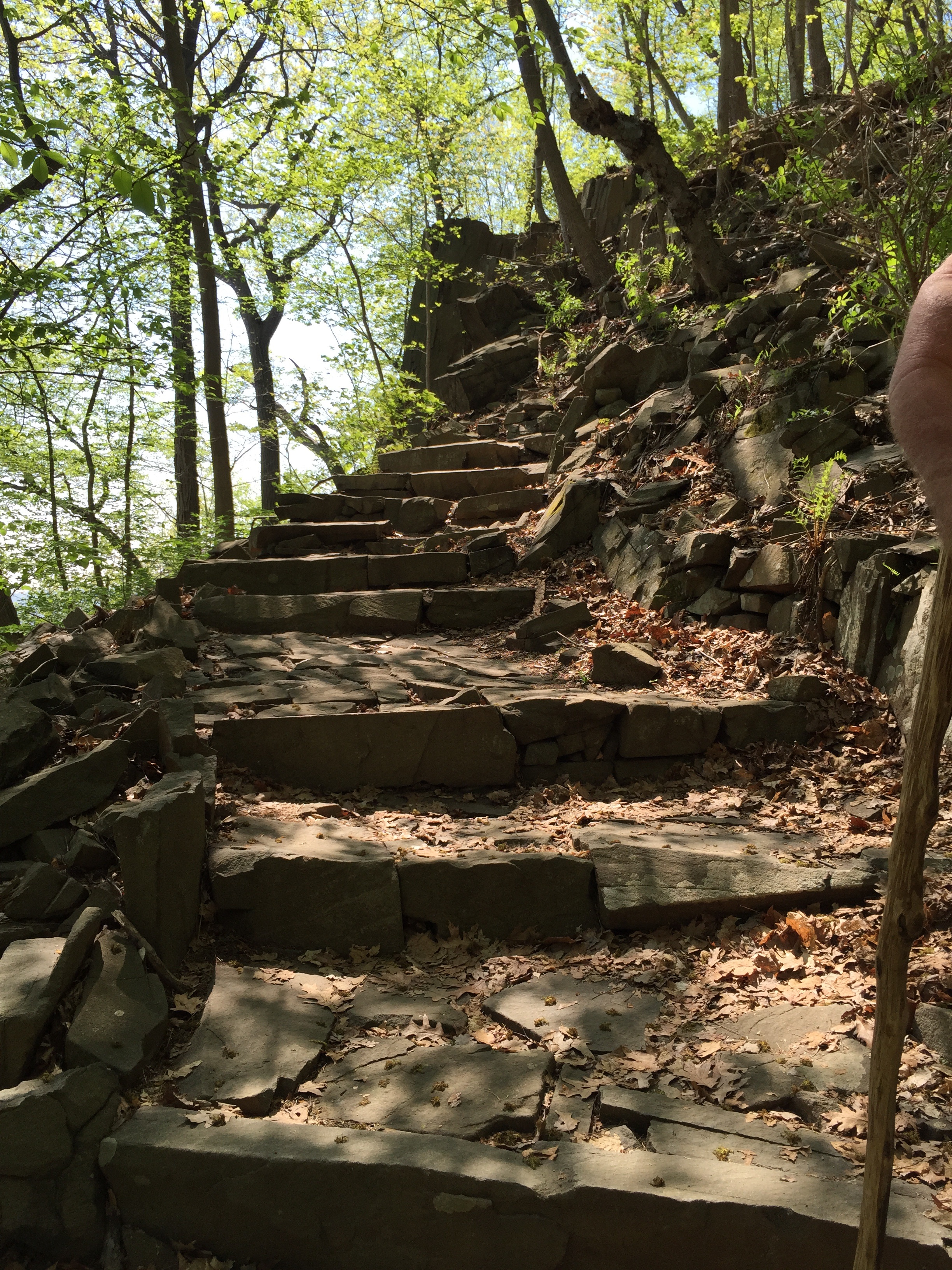
Probably an hour or so later we could tell we were closing in on the New Jersey line. We now started to pay attention, and the only real clue we had was the approximate size of the boulder and the mention that it was located at the high-water line. Firstly, what was the Highwater line in 1769? And secondly, we were looking for a boulder amongst millions of other boulders. Depending on how they are laying down, it is sometimes difficult to estimate the size due to its position in this enormous pile of rocks. But that is all we had to go on, so we pursued it. We split up and started to scour the area, I then noticed what looked like a metal casing in the bottom of a small tree. I have seen those used at surveys of local roads. I showed it to Dan and we knew that we had to pick everything apart in this area. As I looked around, I really doubted the fact that we were going to locate this marked stone. When you are in that spot you are walking on top of boulders, next to boulders and have millions of boulders above you. Keep in mind the description is at high water line. So could that have been 20 feet above you in 1769? The only other clue we had Was that the inscription is on the east face of the rock. So if you are looking for that, you need to lean over the actual river and look back towards your feet for any evidence of writing.
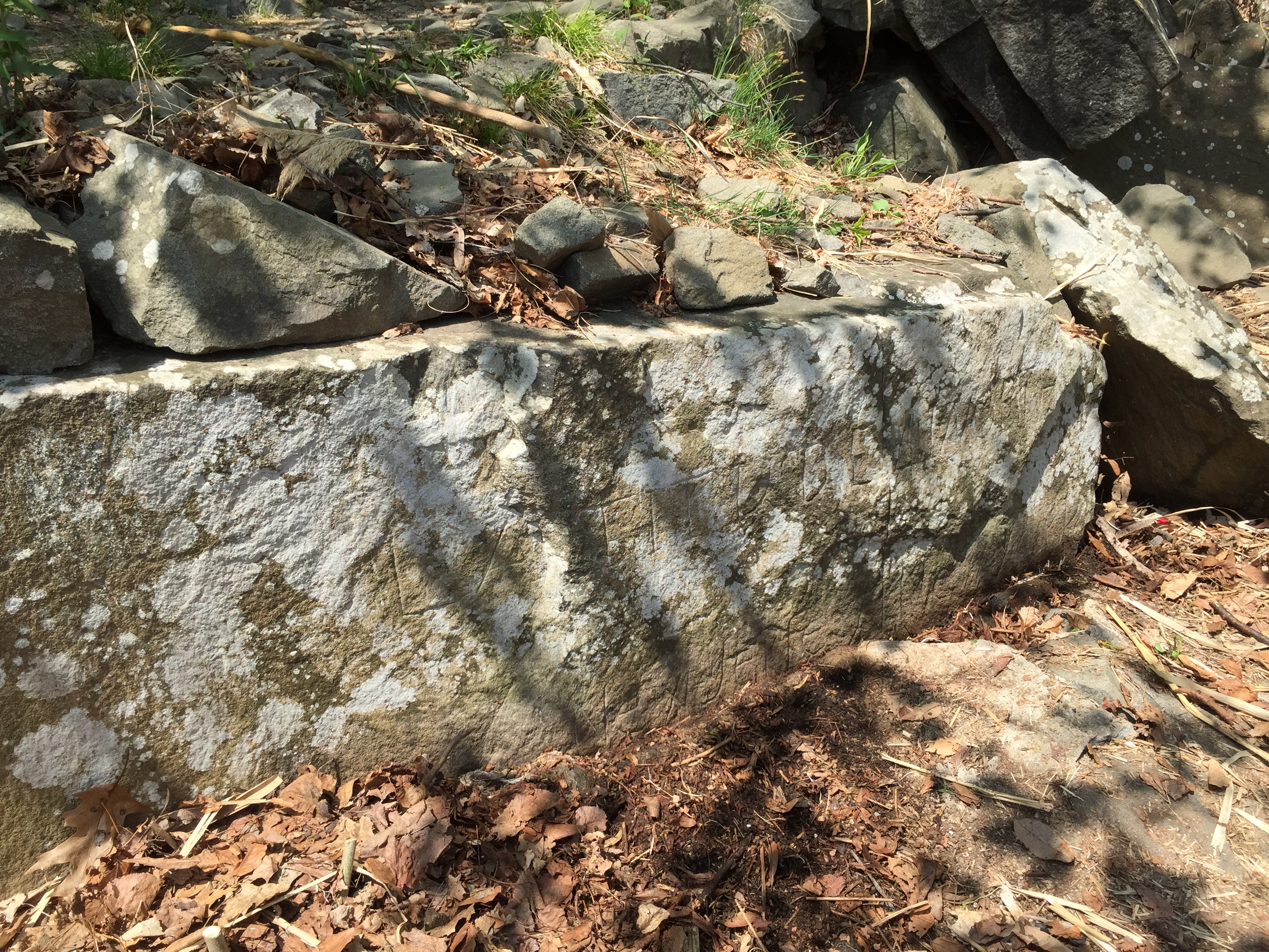
After doing so for quite some time I happened to spot an almost perfectly square cut out in a rock that I was standing on. It was less than an inch square, but I could tell that it was not natural, it appeared to have been made by a chisel! Dan came over and agreed that we were on to something. I took my hiking stick and waved away all the tall river grass that were covering the face of this rock, and he said all’s he heard me mumble was “there are squiggle lines all over the face of this rock”. What I meant was that these must be letters, and Dan could see them because he had jumped down to where he could stand in front of the rock as I cleared it. With the height of the sun leaving this area very shortly, we didn’t even read anything but we immediately removed all the weeds around it so we could get a clearer picture while there was still natural lighting. We could not believe our eyes! There it was with the exact inscription that we had read about! That original chiseled square was cut out purposely to start the chiseled line that went down the face of the rock, which represents the actual border line of these two states! We couldn’t believe how clear it was, even though it has taken the abuse of the Hudson River from the beginning of time. After we recorded its location and documented it with many pictures and spent some time cleaning it up. We sat back and could not believe that we found it. Dan followed that up with his response of “we didn’t come here NOT to find it”.
Funding of the Sussex County Arts & Heritage Council has been made available in part by the NJ State Council on the Arts, a division of the NJ Department of State and a partner agency of the National Endowment for the Arts, through the State/County Partnership Block Grant Program, as administered by the Sussex County Arts & Heritage Council. Additional funding has been made available in part by the New Jersey Historical Commission through the County History Partnership Program, as administered by the Sussex County Arts & Heritage Council. Partial funding provided by the Sussex County Board of Commissioners.
|

Gallery / Office Hours Tuesday - Friday: 10:00 am - 5:00 PM |
Sussex County Arts & Heritage Council is a 501 (c)(3) non-profit organization.